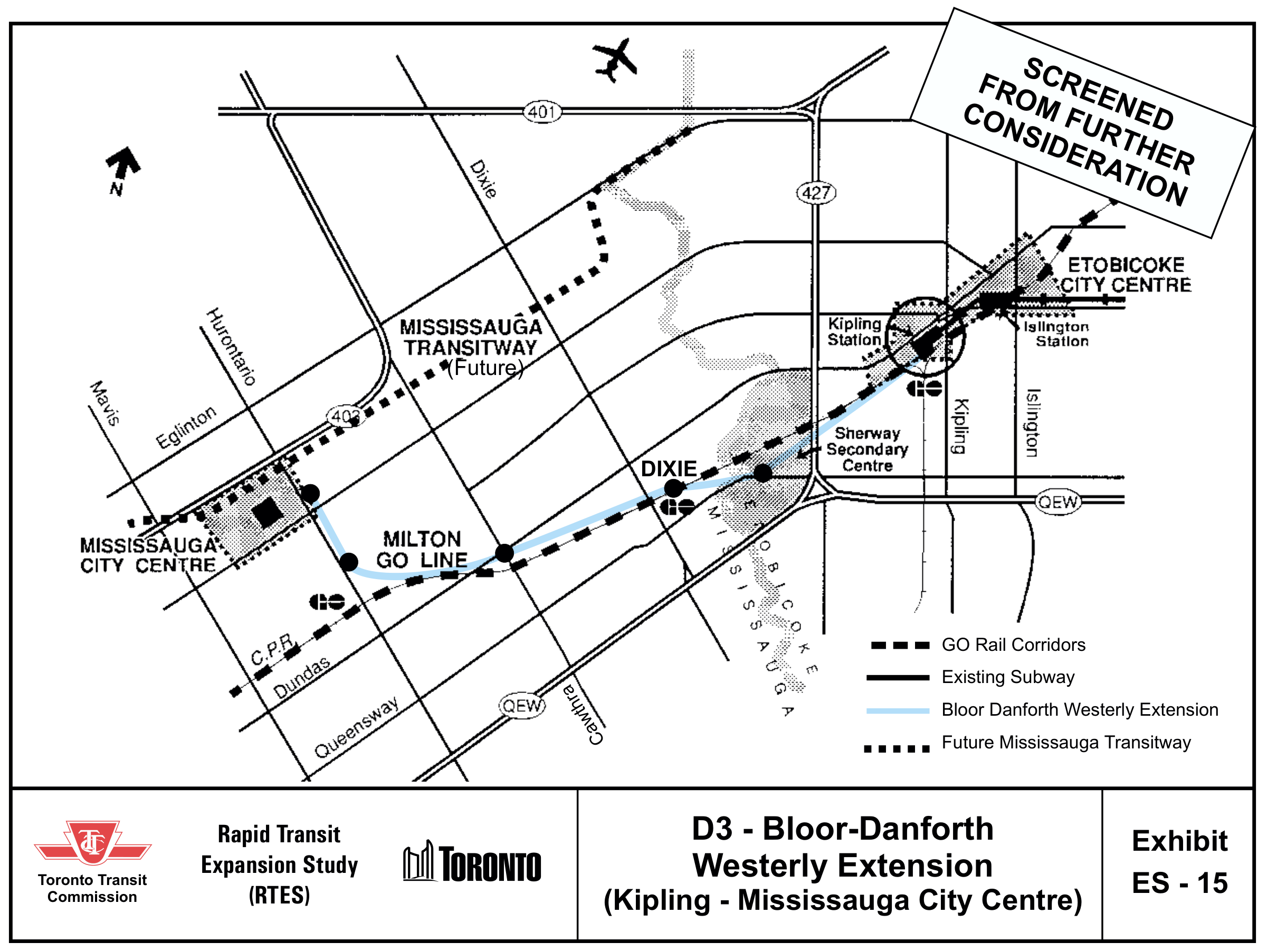
The TTC studied this connection as option D3. It was screened out at the time. Today’s campaign proposal calls for a new business case; this historical map is not an approved or selected route.
Rapid Transit Expansion Study · Exhibit ES-15The original map, with its study outcome preserved. Select the image to inspect it at full size.
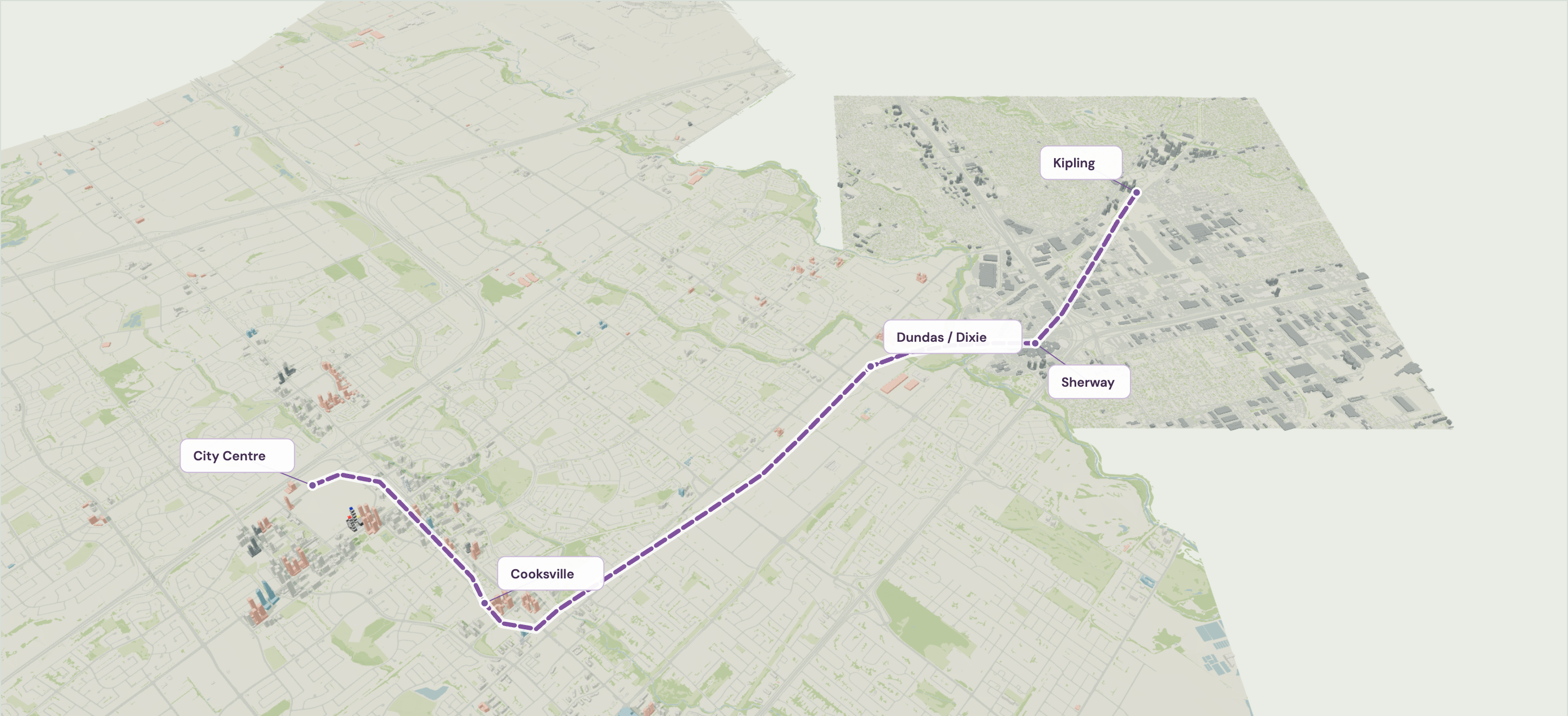
All three dashed purple corridors are exploratory sketches, not engineered routes. Labels mark areas, not station sites; line height does not represent a tunnel or elevated railway. Toronto context uses the City’s 2025 building model. Green GO lines and the gold Hurontario LRT sit within the 3D scene. The LRT is under construction; route elevations are illustrative.
An independent exploration by Daniel Sultan, unaffiliated with the City, TTC, Metrolinx or any campaign. This map is not a route announcement. There is no confirmed alignment, funding or opening date for the connection illustrated here.
01Has this been considered before?
Yes. The City Centre option is shown above in the original Exhibit ES-15. It was screened out because its length and cost put it beyond short- and medium-term priorities. City staff shared public historical records that helped me trace the other options below.
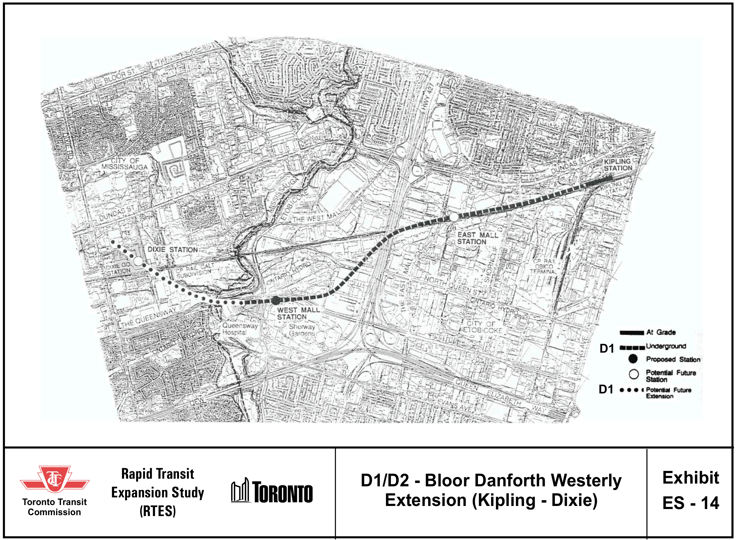
2001 TTC STUDY
A shorter extension toward Dixie.
The TTC compared western options through East Mall and West Mall, with a possible later extension to Dixie. This was a different proposal from reaching City Centre.
Dundas Connects examined a subway alternative ending at Cooksville GO, alongside the older 1993 route toward Dixie. The adopted master plan selected bus rapid transit.
This was a separate study. It did not approve a subway to City Centre.
I think the useful question is how a growing downtown connects to the region. A fresh study could test that against today’s development and transit plans, rather than simply carrying forward a decision made decades ago.
The city model gives the idea context. The purple line is my illustration; future buildings are retained proposals and may change or never be built.
A growing downtown
Mississauga’s plans concentrate new homes, employment and activity in the downtown. That makes it worth testing how many future trips a subway could serve.
The Hazel McCallion Line creates a north–south spine. Cooksville has Milton GO. The City says its downtown bus terminal is already at capacity and is studying a mobility hub with better LRT, bus and Transitway connections.
A Line 2 extension could connect Mississauga destinations directly to Toronto’s subway. Its travel-time and transfer benefits should be compared with Dundas BRT and better GO service.
A business case still needs to compare ridership, cost, travel time, construction impacts and alternatives. It must also test the actual route, station locations and transfers. This model cannot answer those questions on its own.
City of Toronto: 3D Massing, 2025 editionMunicipal building shapes extend the scene through Sherway to Kipling. Source-date context, rather than a survey of every current building.
Model sources and alignment notesData coverage, ground registration and limitations. Contains information licensed under the Open Government Licence – Toronto.
The historical reports supplied through City correspondence were used to check the record. Private messages, contact information and emailed newspaper clippings are not published here.